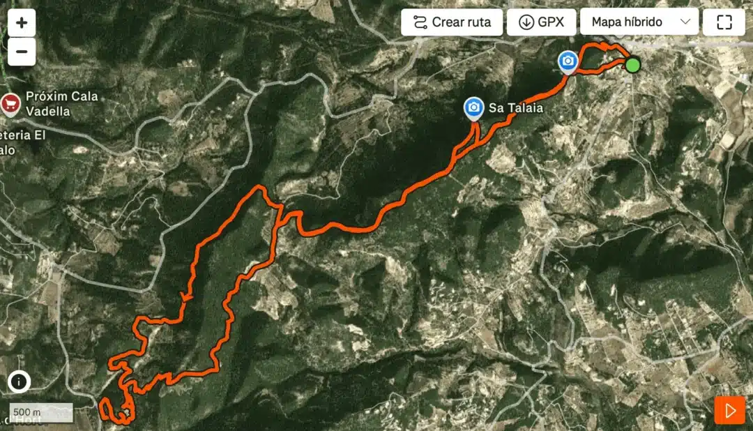
The hiking route to Sa Talaia in Sant Josep is one of Ibiza’s most rewarding outdoor experiences, combining long-distance hiking, panoramic viewpoints and a surprising variety of landscapes. This circular route does not stop at the summit of Sa Talaia, the island’s highest point, but continues across ridges, valleys and secondary high points that showcase a side of Ibiza that many visitors never see. Overall, the route covers approximately 18 kilometres.
Designed for travellers who want to explore beyond the coastline, this hike offers a clear, well-marked journey through pine forests, elevated tracks and quiet inland terrain.
This report provides a detailed, visitor-friendly guide to completing the entire loop, from the starting point in Sant Josep to the summit and far beyond. Whether you are planning your first hiking day in Ibiza or looking to add a challenging but accessible route to your itinerary, the Sa Talaia circuit offers a complete and memorable adventure.
Starting point: a simple beginning in Sant Josep
The route begins at the car park located beside Es Cubells avenue, in the centre of Sant Josep de sa Talaia. It is an easy place to reach by car or taxi, and it situates hikers close to the foothills of the mountain.
From the car park, follow the road, then take the first left turn onto Metge Street. After a short distance, turn left again onto Sa Talaia Street. This quiet residential street soon leads out of the village. A few minutes later, the asphalt ends and becomes a wide and clearly identifiable dirt track, signalling the start of the rural portion of the hike.
This initial section is ideal for orienting new visitors. Navigation is straightforward, the path is obvious, and the views of the surrounding hills begin to appear almost immediately.
The first climb: approaching Ibiza’s highest peak
The dirt track begins a steady and consistent ascent. The path is wide throughout this section, allowing hikers to progress comfortably without the need to navigate narrow or technical terrain. The gradient increases gradually, creating a smooth transition into the mountain environment.
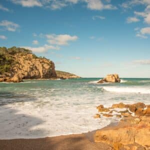
Pine forests dominate this first climb, offering shade and a distinctly Mediterranean atmosphere. The track winds through the trees, opening at times to reveal glimpses of the island’s southern landscape.
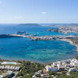
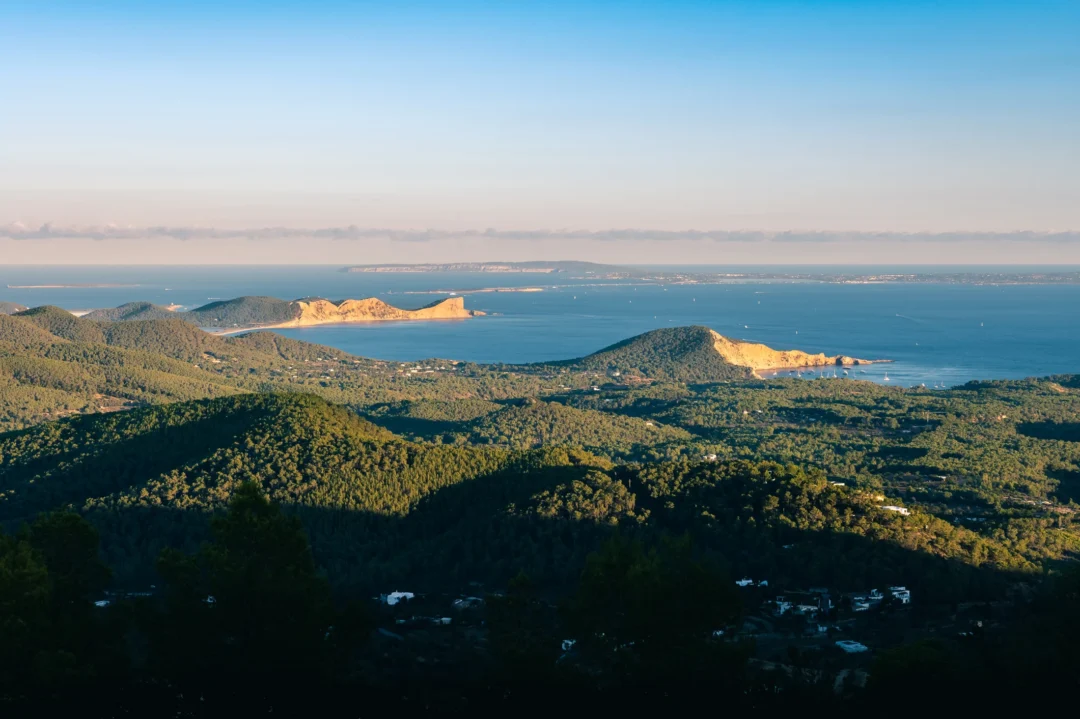
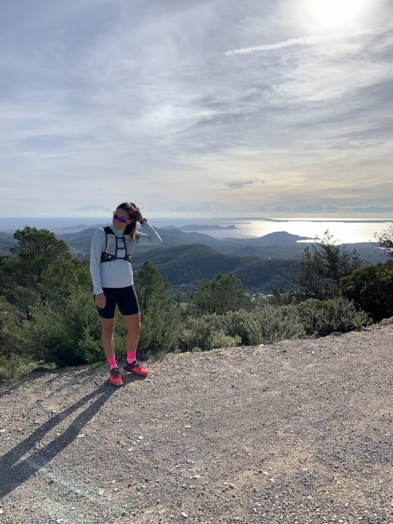
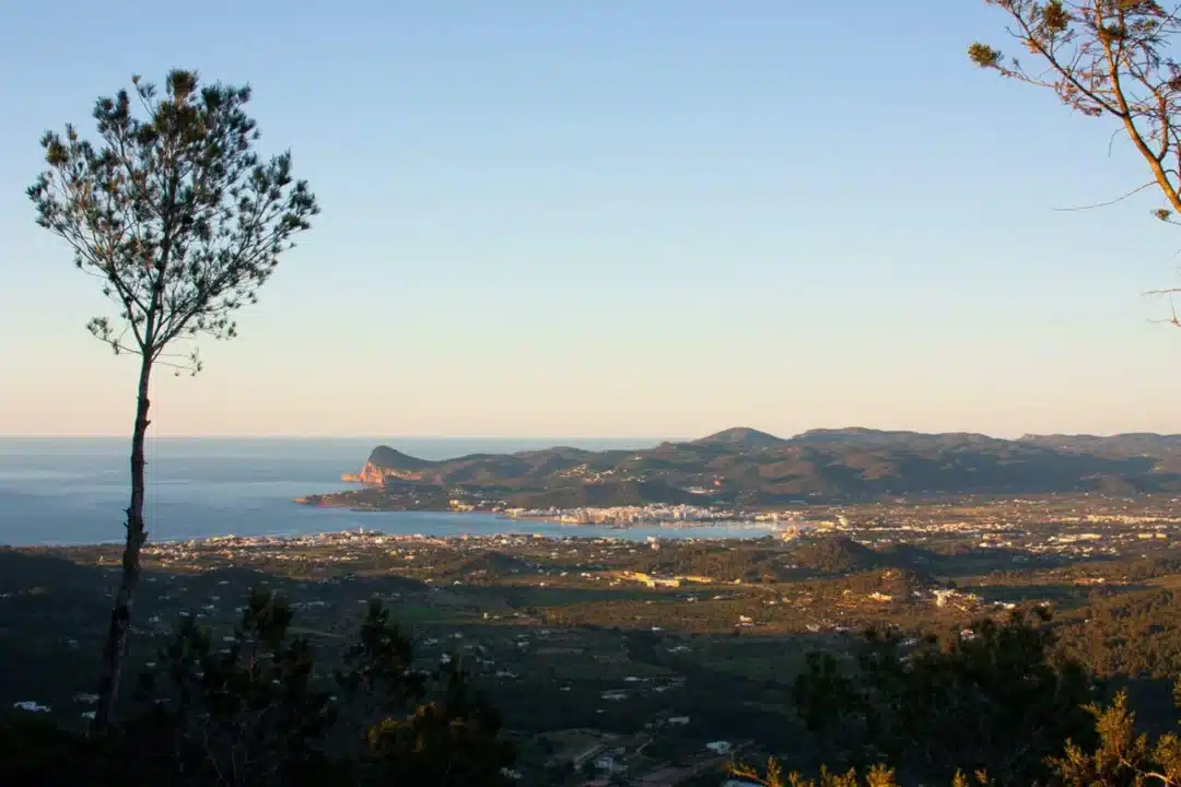
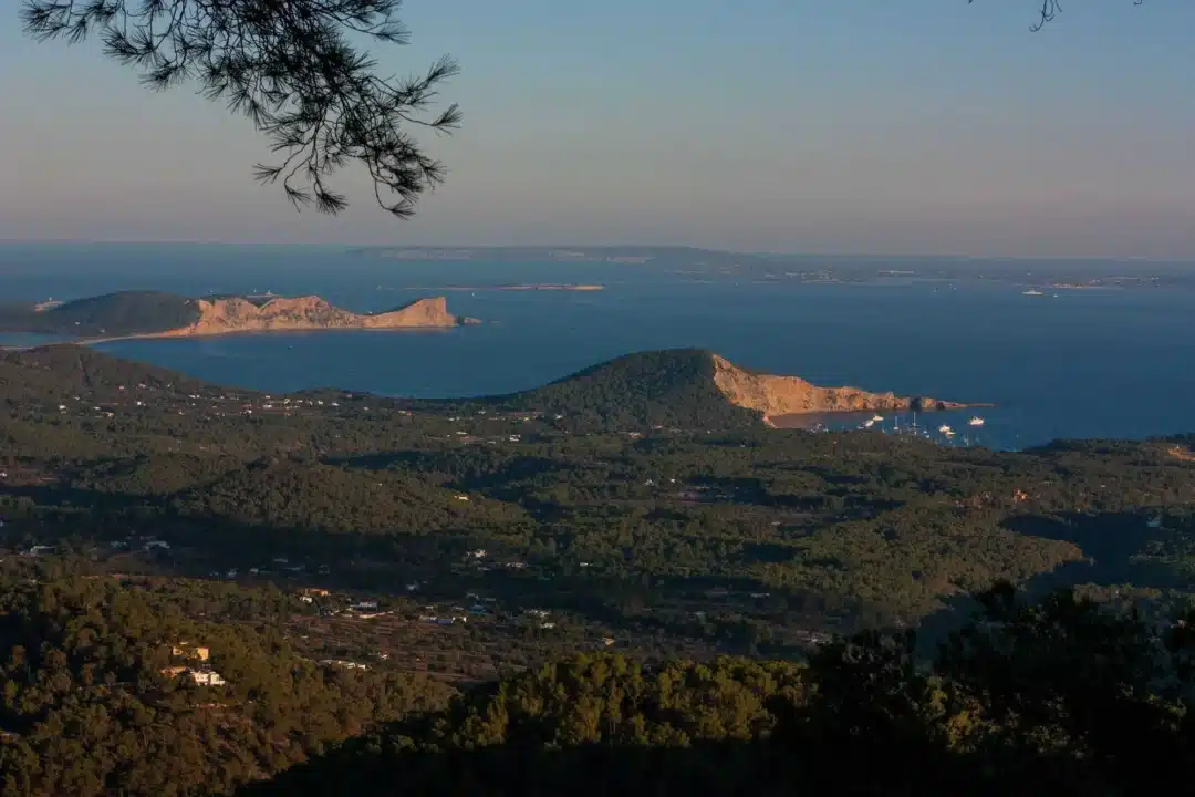
After roughly two and a half to three kilometres, the track reaches the peak of Sa Talaia (475 metres). Identified by its telecommunications antennas, the summit provides one of the most complete viewpoints in Ibiza. From here, visitors can enjoy sweeping views over:
- The iconic island of Es Vedrà
- The coastline of Sant Josep
- The long stretch of Platja d’en Bossa
- The historic silhouette of Dalt Vila
- The island of Formentera
- On very clear days, it is possible to see the Iberian Peninsula in the direction of Valencia
Although many walkers complete only the ascent to the summit, the full Sa Talaia circuit offers much more. The real journey begins when you continue beyond the antennas.
Beyond the summit: ridge walking and wide-open views
From the summit area, the route continues along a ridge track that runs behind the peak. This section is one of the most rewarding parts of the entire circuit, offering a combination of elevation, quiet surroundings and occasional open viewpoints into the valleys below.
The ridge undulates gently, creating a rhythm of small climbs and descents. The forest becomes thinner in some areas, allowing hikers to enjoy wide views across the south-west of Ibiza. Throughout this section, the track remains easy to follow, maintaining its character as a wide and comfortable forest road.
Gradually, the route begins to descend. The environment becomes greener and more enclosed, and by kilometre eight or nine, hikers reach the lowest elevation of the entire route, around 110 metres. This point marks the transition between the high ridge and the valley area—a peaceful midpoint ideal for resting or rehydrating.
The second ascent: a longer but softer climb
From the valley floor, the trail turns into a long, progressive ascent that leads towards the second major high point of the route. Unlike the steeper climb to the main summit, this ascent is smoother and more regular, allowing hikers to establish a comfortable pace.
The track winds among pine forests once again, with extended stretches of consistent elevation gain. It is a pleasant and calm section of the route, popular among hikers who enjoy sustained climbs without technical difficulty.
Approaching kilometre fifteen, the trail reaches a secondary ridge above 400 metres, providing new viewpoints and a fresh sense of scale. While not as high as Sa Talaia, this ridge is an excellent vantage point for observing the inland landscape and the varied terrain of the route completed so far.
The final descent back to Sant Josep
After the second ridge, the route begins its gentle descent back towards Sant Josep. The track remains broad and easy to follow, allowing hikers to enjoy the final kilometres at a relaxed pace.
As the descent continues, the pine forests gradually open, and familiar sights from the beginning of the walk reappear. Eventually, the dirt track reconnects with Sa Talaia Street, returning hikers to the residential outskirts of the village. Following the same streets used at the start, the route concludes once again at the car park beside Es Cubells avenue.
The full circuit covers approximately 18 kilometres, with a cumulative ascent of nearly 800 metres, making it a substantial but accessible adventure for visitors looking to explore Ibiza’s interior.
Curiosities about Sa Talaia
Sa Talaia is more than Ibiza’s highest point. It also holds cultural and historical importance:
- The name ‘Talaia’ comes from the Catalan word for ‘watchtower’. The mountain was historically used to watch for pirate ships approaching the island.
- On the clearest winter days, you can distinguish the coast of mainland Spain from the summit.
- The mountain forms part of Ibiza’s natural defence system, used for centuries to monitor maritime movement.
For travellers who enjoy combining nature with history, Sa Talaia offers both in an accessible form.
Essential information for visitors
Who is this hiking route for?
This 18-kilometre hike is ideal for:
- Travellers looking for an active, full-day experience
- Hikers accustomed to medium or long distances
- Visitors wanting to explore inland Ibiza and avoid crowded areas
Navigation and terrain
- The majority of the route follows wide and well-defined tracks.
- Suitable for confident walkers, even without advanced navigation skills.
- A GPX file is recommended but not essential on clear days.
What to bring
- Hiking shoes or comfortable trail footwear
- A minimum of 1.5 to 2 litres of water per person
- Sun protection and a hat
- Snacks or light lunch for the midpoint valley section
- A windproof layer in winter months
When to go
- Spring and autumn offer ideal temperatures.
- Winter provides crisp air and maximum visibility.
- Summer is possible with early starts to avoid midday heat.
A route that showcases the real Ibiza
Completing the full Sa Talaia circuit allows visitors to experience a different Ibiza: peaceful, natural and surprisingly varied. This hike reveals the island’s mountainous interior, its forested ridges, and its lesser-known valleys, offering a contrast to coastal landscapes while remaining fully accessible from Sant Josep.
For travellers seeking depth, discovery and a complete perspective of Ibiza’s geography, the 18-kilometre Sa Talaia route stands out as one of the island’s most rewarding adventures.